
SBG Systems announces the release of the first MEMS-based Gyroscope
A MEMS-based gyroscope for demanding underwater and geospatial applications.
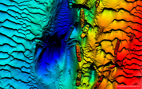
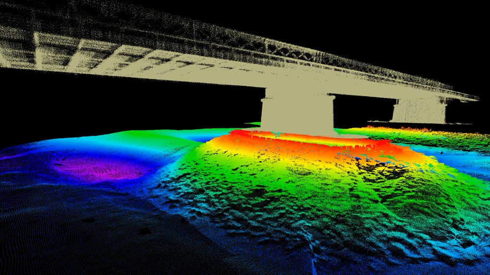
Bathymetry consists of defining the relief of the seabed by determining the height of water georeferenced by means of underwater acoustic sensors (single-beam or multibeam echosounders, sonars, probes, etc.), a surface GNSS receiver and analysis of the acquired data.
The term bathymetry comes from ancient Greek: “bathys” (deep) and “metron” (measurement, instrument for measurement).
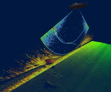
In comparison with the surveyors who carry out the topography of the earth’s surface, the bathymetry aims to map the relief of the seabed.
By conducting bathymetric surveys, the analysis of these reliefs aims to improve:
A bathymetric survey is a measure of water height and distance made with a sensor (single beam or multibeam echosounder, probe, sonar, etc.) combined with a professional and precise GNSS system to determine the geographical positioning.
The steps for conducting a bathymetric survey vary depending on the type of boat and the environment to be surveyed; here is a non-exhaustive list:
There is no defined time since each bathymetric survey is different and depends on several criteria: the area to be raised, the weather (sometimes tides) and the density of the survey.
Once the survey is carried out with the bathymetric probes, the raw data can be used in several forms after analysis and processing.
During the processing process, inconsistent data is discarded when they do not correspond to the reality of the field, this is done automatically (using filters) or manually. This step is necessary to achieve accurate and reliable results.
Once processed, these results are available in several formats:
Bathymetry has many different applications:
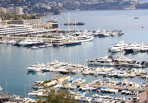
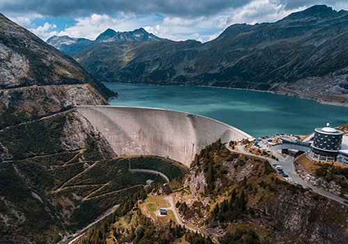
All the different water zones, natural or artificial, and the different depths are conducive to the realization of bathymetry surveys: sea, ocean, lake, lagoon, river, canal, stretch, pond, bridge, port area, dam, dike, quarry, etc.
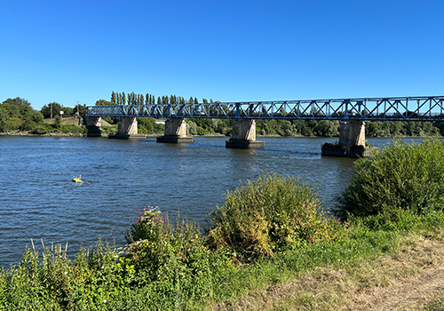
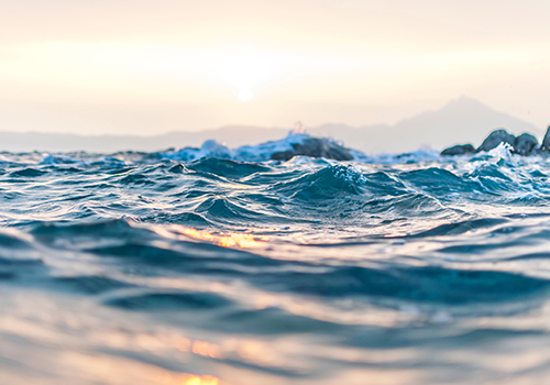
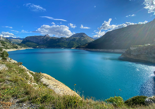
A complete bathymetry system consists of a single-beam or multibeam sounder, usually associated with other sensors. In the case of a boat with the integration of a single beam sounder, most situations require only a GNSS receiver in addition.
Equipment with a multibeam sounder:
A single-beam or multibeam system is usually directly integrated on a hydrographic vessel, a marine drone or an underwater drone (ROV/AUV). A software suite completes the installation to perform the acquisition, analysis, processing and interpretation of bathymetric data.
A depth echosounder is used to measure the depth below the surface of the water. There are two types of bathymetric echosounders: the single-beam sounder and the multibeam echosounder.
The bathymetric echosounder sends an acoustic wave reflected from the seabed, the echo emitted is received by the same transducer. The travel time of the sound gives information on the distance from the background.
The speed of sound varying below the surface of the water (about 1450 m/s) as a function of salinity, temperature and pressure, the depth sounder provides a precise distance between the sensor and the ground in real time.
Depending on the case, these many parameters require real-time or delayed corrections to best adjust the raw water height measurement.
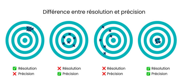
The single-beam sounder has a single emission cone. Depending on configurations and vendors, it can be single and/or bi-frequency:
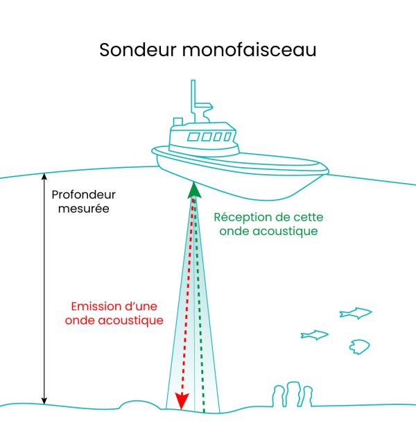
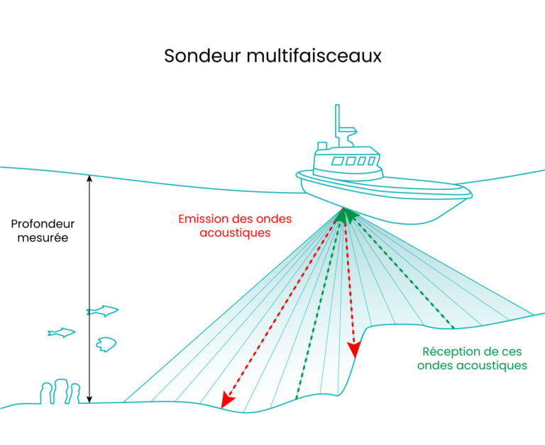
Unlike the single beam echosounder, the multibeam echosounder emits a pulse several times per second, in several hundred emission cones. This method offers many advantages; the main one being to obtain a larger coverage in a single passage.
The latest equipment, such as the R2Sonic series of depth echosounders, offer several additional features related to the georeferenced water height measurement:
Bathymetric probes are generally available in single-frequency mode, with some versions in bi-frequency mode.
Unlike the mono-frequency echosounder, the bi-frequency echosounder is able to provide a first level of characterization of the seabed, by detecting the layer of loose sediment: the highest frequency (200 kHz) stops on the top of the sediment, the lowest frequency (about 30 kHz) penetrates the loose sediment.
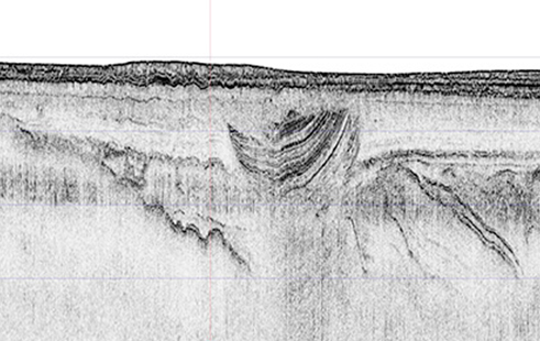
The sub bottom profilers uses very basic frequencies (from 1 to 15 kHz) and aims to detect the different strata of the marine subsurface. This requires a sufficient height of water for the strong acoustic signal to form properly in the water column.
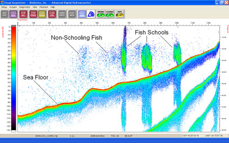
The scientific echosounder favours multi-frequency transducers (high and low frequencies) and processes the feedback of acoustic signals in order to detect and measure biomass:
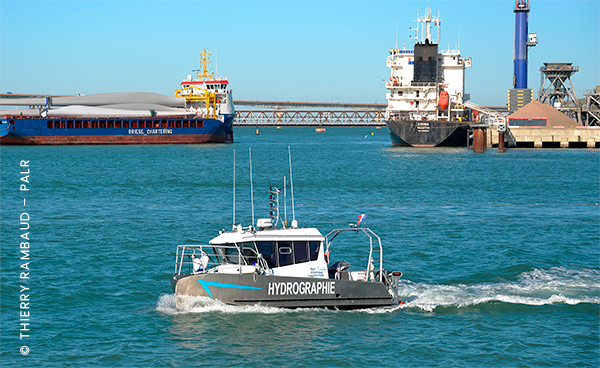
Integrated with single beam or multibeam echosounders, a hydrographic boat is a boat generally used in maritime areas with great depths and over long distances: oceans, lakes, rivers, channels…
Its objective is the search for wrecks, rocks and obstructions, the monitoring of cables or the environmental analysis for work at sea.
Discover the Port Atlantique de La Rochelle case study
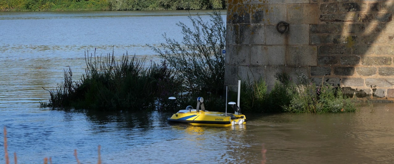
Unlike the hydrographic boat, the USV for bathymetry is a compact and easy to operate system. It also incorporates a single-beam or multibeam echosounder as well as numerous sensors to collect data on the seabed terrain.
The USV carries out bathymetric surveys in contexts where access is restricted for a conventional boat because of a low draught, for safety reasons, such as at the foot of a dam or in areas with strong eddies. Operators stay ashore dry and safe.
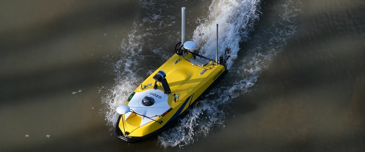
Compact, manoeuvrable and responsive, a USV for bathymetry maps the seabed precisely with several speeds (up to 5 m/s) depending on the need and conditions of navigation.
With a manual and autonomous mode, the surface drones dedicated to bathymetry are designed to follow a programmed path at the beginning of the survey using the integrated precision GNSS receiver.
Compared to a traditional boat, with at least one operator and one navigator in charge of safety, launching operations are much faster since a USV requires only one operator.
Several options are provided to get further information.
Did you like this article ?
Share it with your colleagues or friends
Read next

SBG Systems announces the release of the first MEMS-based Gyroscope
A MEMS-based gyroscope for demanding underwater and geospatial applications.
Sonardyne unveils the SPRINT-Nav U: precision and compactness
The new ultra-compact Sprint-Nav U for integration on UAVs, ROVs and USVs
A look back at the CADDEN 2024 Technical Day
An event packed with conferences, workshops and celebrations!

Tous droits réservés – 2024
Vos données sont collectées et traitées pour vous envoyer notre newsletter et améliorer l’expérience utilisateur du site web. Dans ce cadre, le responsable du traitement est CADDEN. Vous disposez d’un droit d’accès, de rectification, et de suppression de vos données, ainsi que d’un droit de limitation, de portabilité ou d’opposition. Pour exercer ces droits, vous pouvez nous contacter via le formulaire de contact. Pour plus d’informations sur la façon dont nous traitons vos données personnelles, vous pouvez consulter notre Politique de confidentialité.